
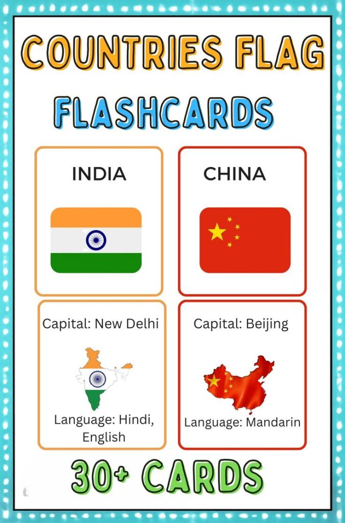
Explore the globe from your classroom, living room, or homeschool setup with these beautifully designed Country Flags Flashcards! Each card is more than just a flag! It’s a bite-sized passport to learning.
Featuring the national flag on one side and essential facts like the capital city and official language on the other, these flashcards make learning geography a hands-on, exciting experience.
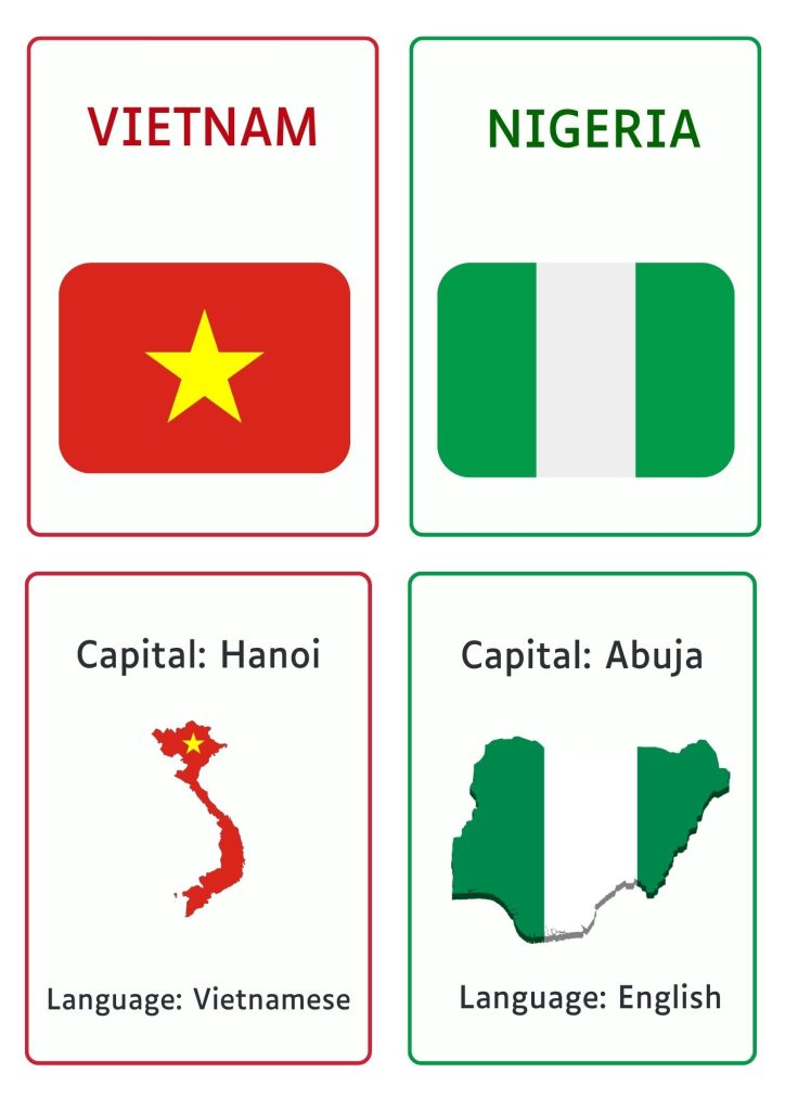
From Japan to Brazil, Nigeria to Finland, this set introduces learners to countries across continents. It’s a rich, visual way to learn about:
- Flags and national symbols
- World capitals
- Languages spoken across the globe
Be it teaching kids, learning yourself, or adding flair to your educational tools, this set is your go-to for global learning.
Who Can Use These Flashcards
- Students (Elementary to High School) learning geography or prepping for quizzes
- Teachers and homeschoolers looking for visual aids
- Parents who want to make screen-free learning fun
- Adults preparing for travel or just brushing up on world knowledge
- ESL learners and multilingual families to connect language with location
Suitable for All Age Groups
These flashcards are designed to grow with the learner! Be it introducing your toddler to world flags or helping a high schooler ace geography, this set fits every stage:
- Ages 3–6 (Preschool & Early Learners): Use the flashcards to build early visual recognition and spark curiosity about different countries through colourful imagery.
- Ages 7–12 (Primary & Middle School): Great for geography homework, classroom quizzes, and school projects. Kids love testing each other on capitals and languages!
- Ages 13+ (Teens, ESL Students & Young Adults): Ideal for reinforcing academic concepts, prepping for exams, or even learning for fun. The capital + language pairing makes these great for social studies or global studies learners.
- Adults & Lifelong Learners: From studying for a citizenship test, learning a new language, or just wanting to brush up on world knowledge, these flashcards are a quick and effective tool.
Features
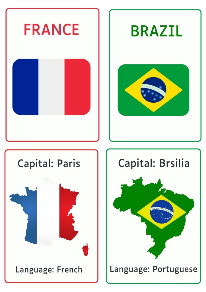
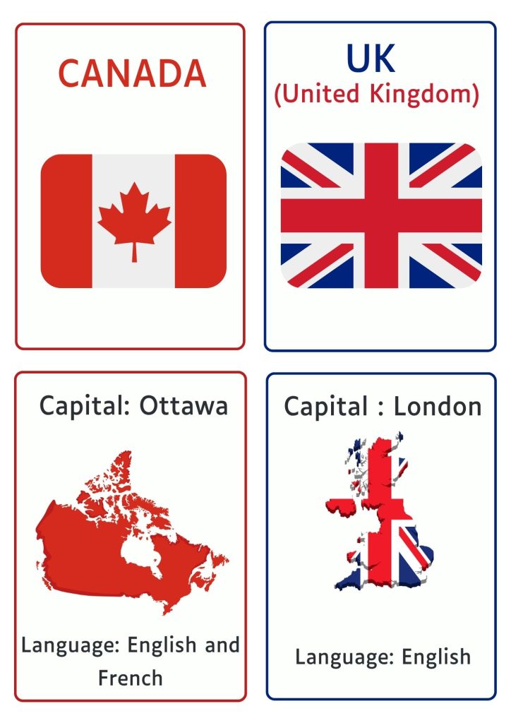
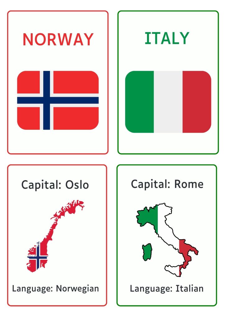
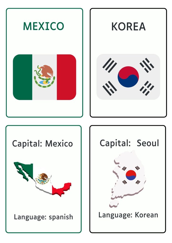
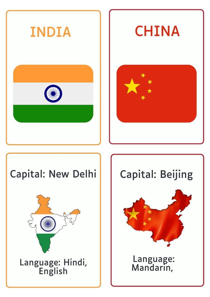
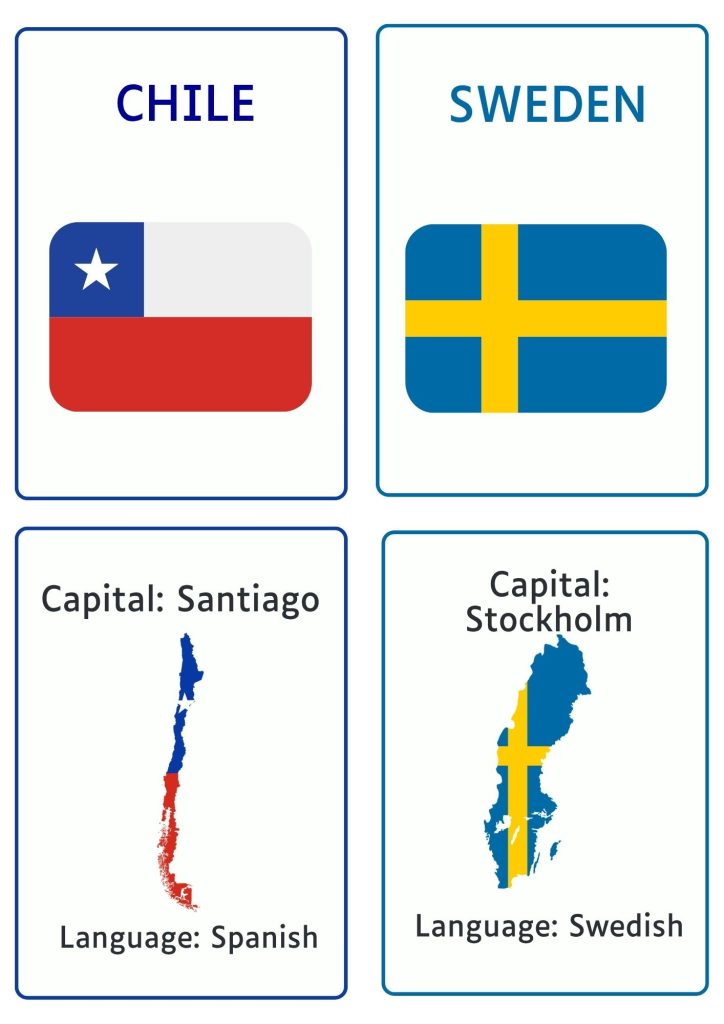
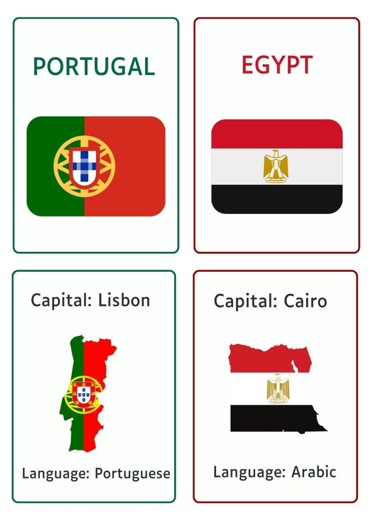
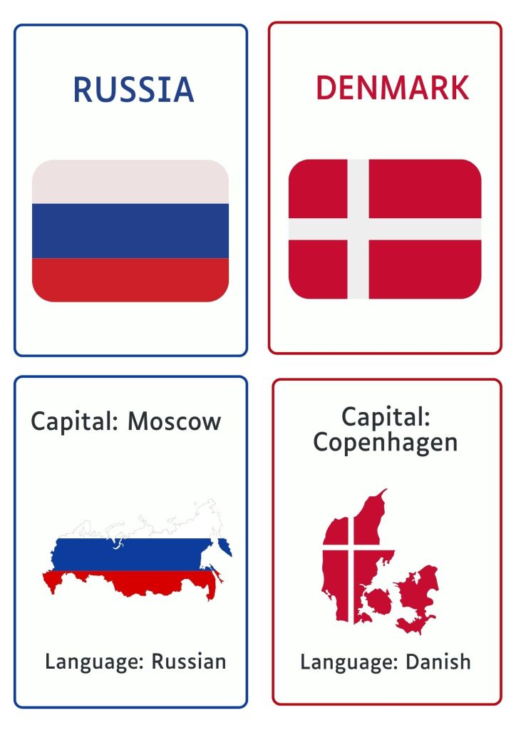
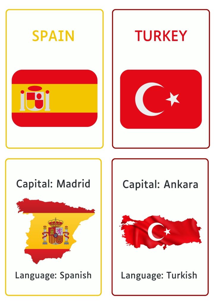
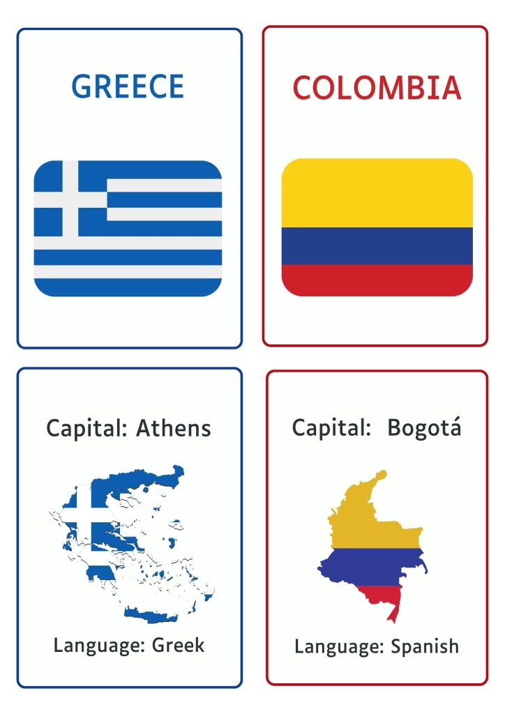
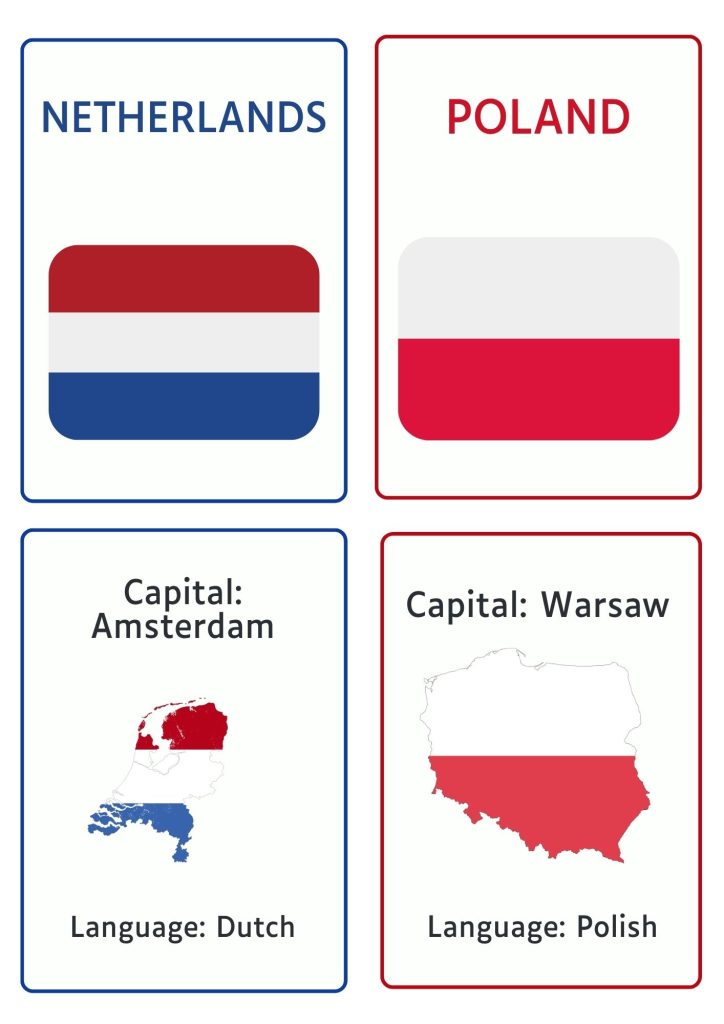
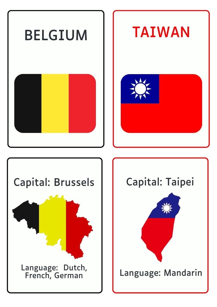
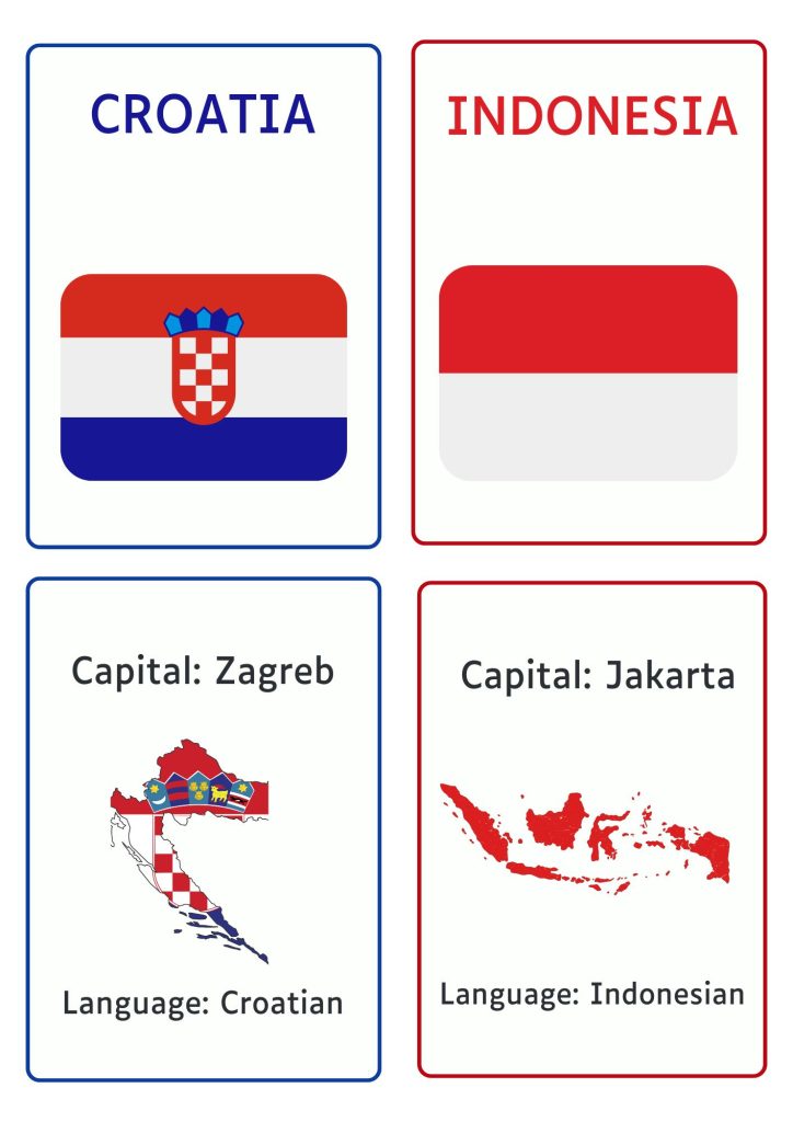
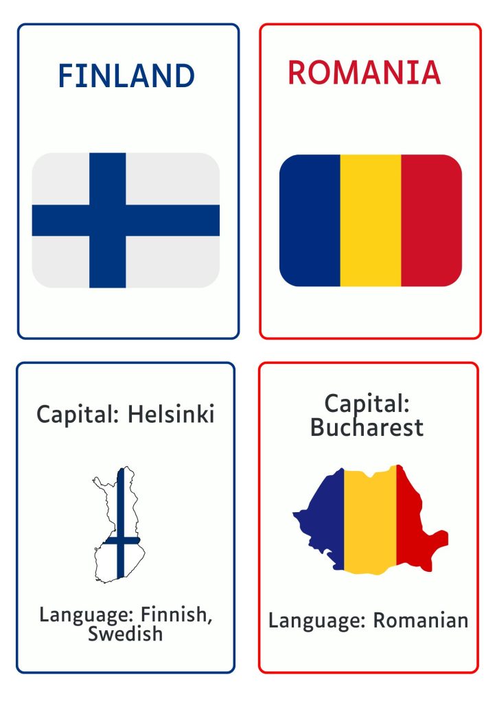
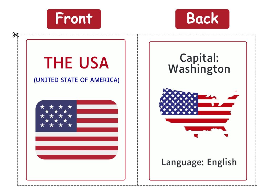
- Includes 30+ Country Flags with Clearly Labelled Capitals and Languages: From Japan to Colombia, each card introduces a new country along with its capital city and official language.
- Double-Sided Design – Flag on the Front, Facts on the Back: Each flashcard is thoughtfully designed to offer two-sided learning: the front showcases a bold, full-colour flag, while the back delivers key details like capital and language. Flip, quiz, and repeat.
- High-Resolution and Ready-to-Print PDFs: Get beautifully crisp images in PDF format – no pixelation, no formatting fuss!
- Printer-Friendly A4 Layout for Easy Cut-and-Go Setup: All pages are sized for standard A4 sheets to make home and school printing effortless. Just print, cut along the lines, and you’re ready to explore the world.
- Clean, Minimal Layout for Distraction-Free Learning: We’ve kept the design modern and fuss-free so learners can focus on what matters, absorbing the names, flags, and facts without visual clutter.
- Perfect for Classrooms, Travel Kits, Bulletin Boards, and Quiz Decks: These flashcards are versatile and portable. Use them to decorate a geography corner, create a travel-themed classroom wall, stash them in your bag for learning on the go, or make them part of a fun trivia game night!
Images


How to Print
Get started in just a few clicks! These flashcards are designed to be printed double-sided, so the flag appears on the front and the country’s capital and language on the back, just like a real flashcard.
Option 1: Double-Sided Printing (Recommended)
- Open the PDF file using Adobe Acrobat Reader or any browser that supports double-sided printing.
- Click File > Print or tap the Print icon.
- In your print settings:
- Paper Size: Set to A4
- Page Sizing: Select “Actual Size” or “Fit to Page” (either works, but be consistent)
- Print on Both Sides: Choose “Flip on short edge”
- Orientation: Usually, Portrait works best
- Paper Size: Set to A4
- Click Print, then cut along the outlines to get perfectly aligned double-sided flashcards!
Note: Why “Flip on Short Edge”?
This setting ensures that when you flip the printed page, the front and back align correctly, just like a traditional flashcard. Choosing “Flip on long edge” may cause the back to be upside down!
Option 2: Manual Double-Side Printing
- Print all the odd-numbered pages first (these are the flag sides).
- Once done, flip the printed pages and place them back into your printer tray in the correct orientation.
For most printers, this means face up with the top of the page going in first — but do a quick test print to be sure. - Now, print all the even-numbered pages (the back sides with country facts).
- Cut the cards and voila! You have your own back-to-back geography flashcards!
Want durability? Print on cardstock or laminate the cards to create a long-lasting, reusable learning set!
How to Use
Make geography unforgettable with these 5 creative, educator-approved ways to use your flashcards:
- Play & Learn: Turn geography into a game night hit! Stack the flashcards in a bowl or shuffle them face down. Each player takes turns picking a card, reading the country name aloud, and racing to find it on a globe or world map.
For an extra twist, flip the card and match the flag with its correct capital and language!
- Classroom Decor or Bulletin Board Borders: Brighten up your classroom or study nook by stringing the flags across a wall or pinning them to a corkboard with the facts below. They double up as decor and reference material!
- Memory Booster – Quick Recall Drills: Hold up the flag and ask: “Which country is this?” or “What’s the capital?” You can even flip it and quiz on the language. Great for review sessions and active recall exercises.
- Travel-Inspired Learning – Plan an Imaginary Trip: Choose a few cards, and let your child plan an “imaginary vacation.” What languages will they need to learn? What’s the capital city? This sparks curiosity and connects learning with real-world experiences.